

 14 mins ago | Updated 6 mins ago
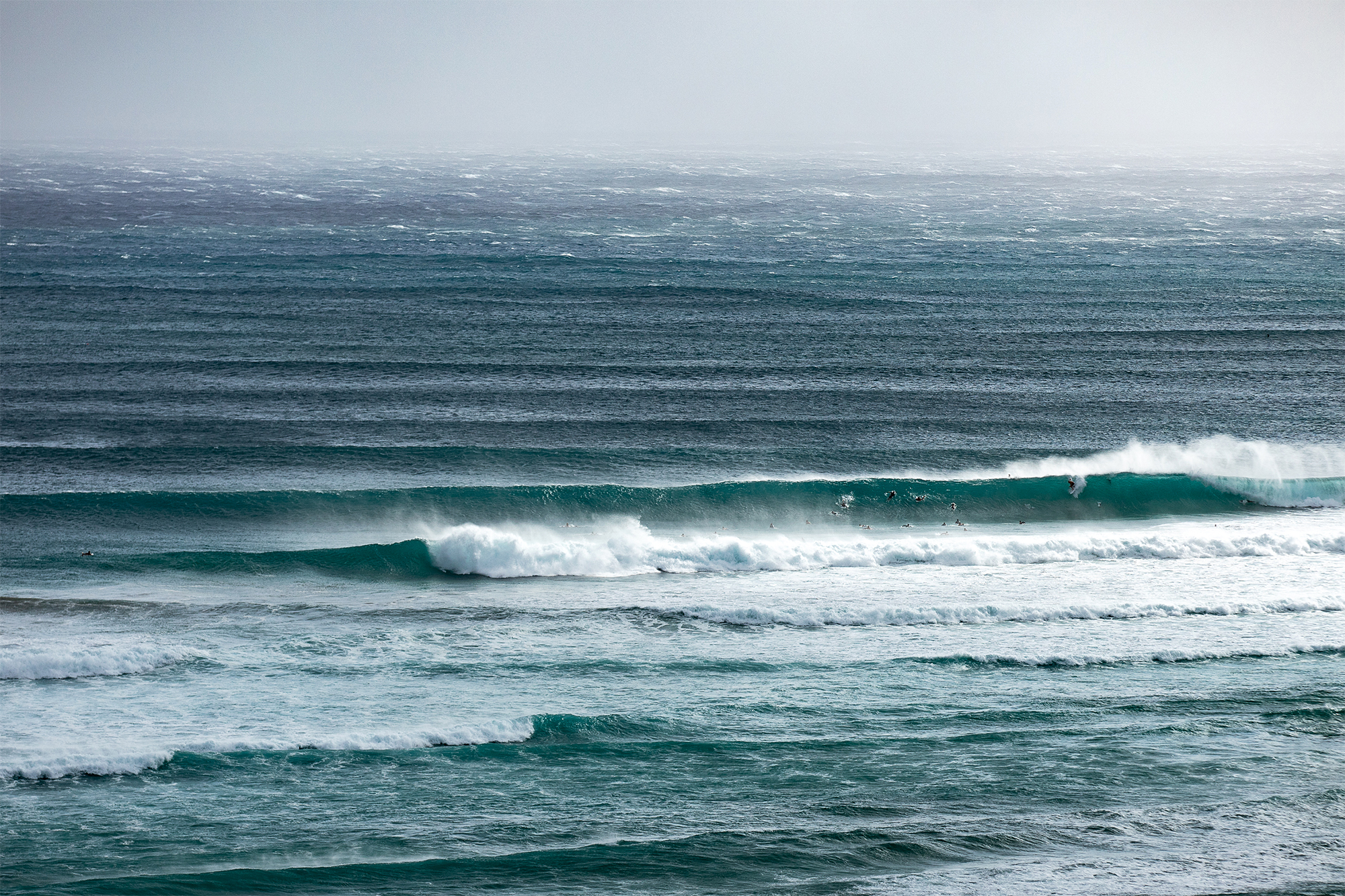
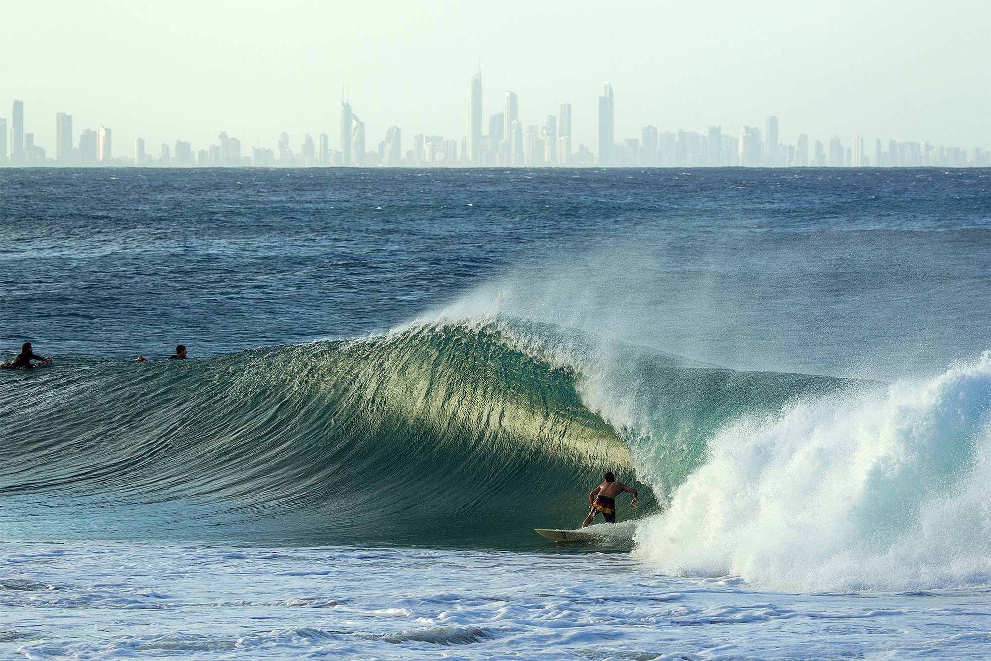
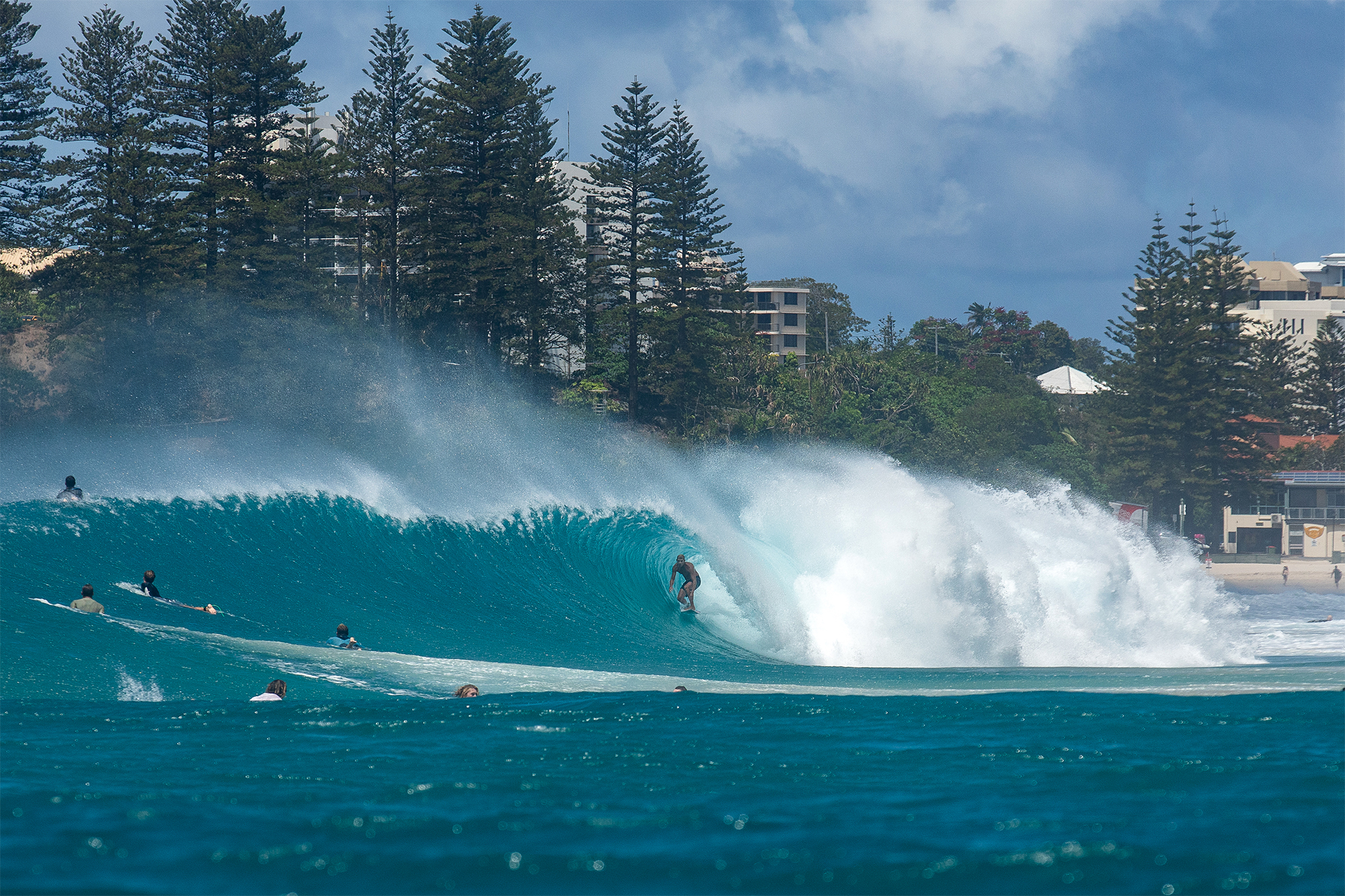
It’s been a wild week on the Gold Coast of Australia. Surfline’s ace forecasters have been tracking Cyclone Oma over the past few days as it’s pumped out day after day of pumping surf to the myriad sand points of the region.
Above and Top: Photos: Juan Medina
“Cyclone Oma sank south through the week, entering the Queensland swell window with a peak intensity at 75 knots and satellite-observed winds of 50 knots from within the region’s swell window,” explains Surfline forecaster Mike Watson. “The wind field overall was pretty expansive, with a wide area up to gale force covering much of the Coral Sea off of the Queensland coast.”
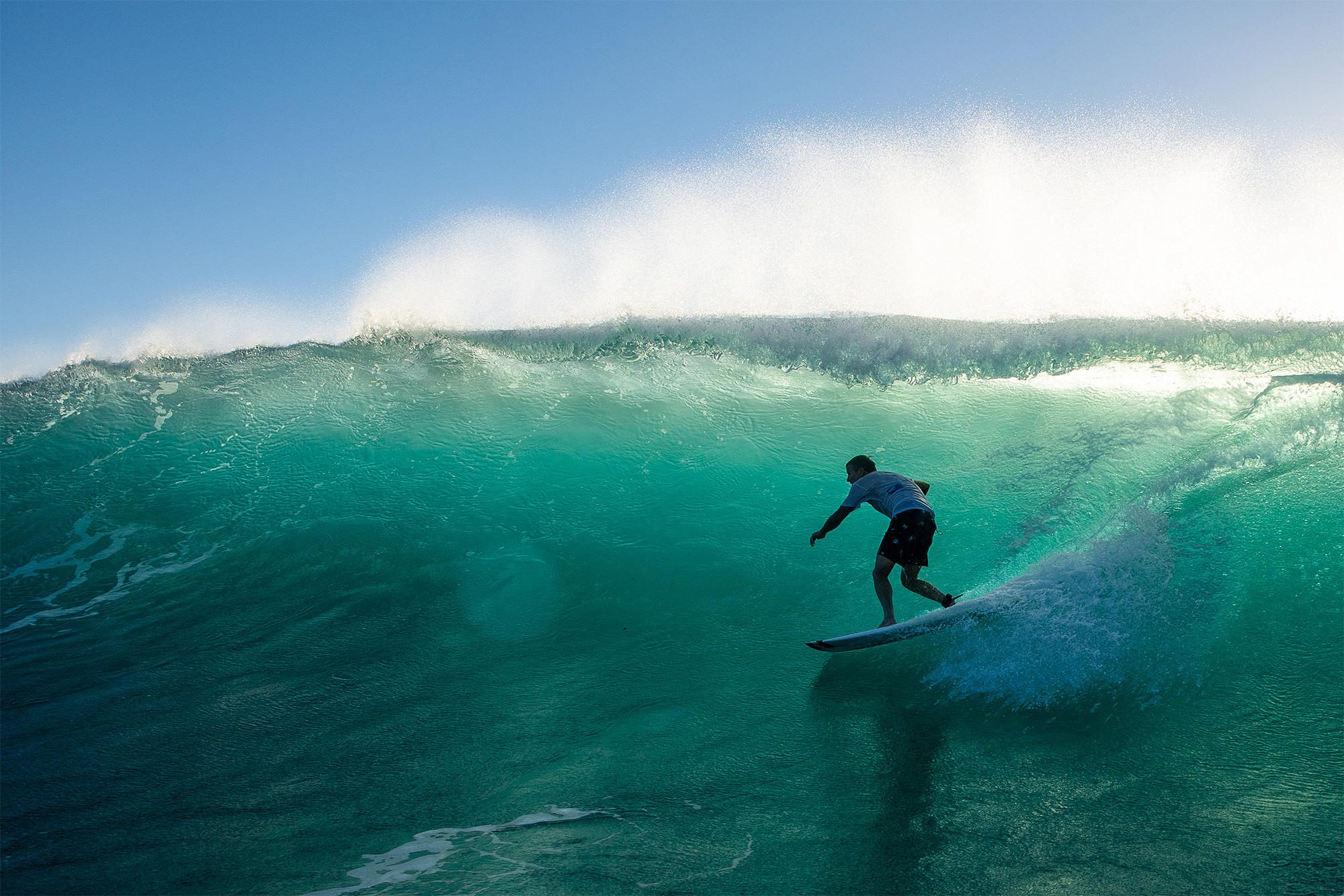
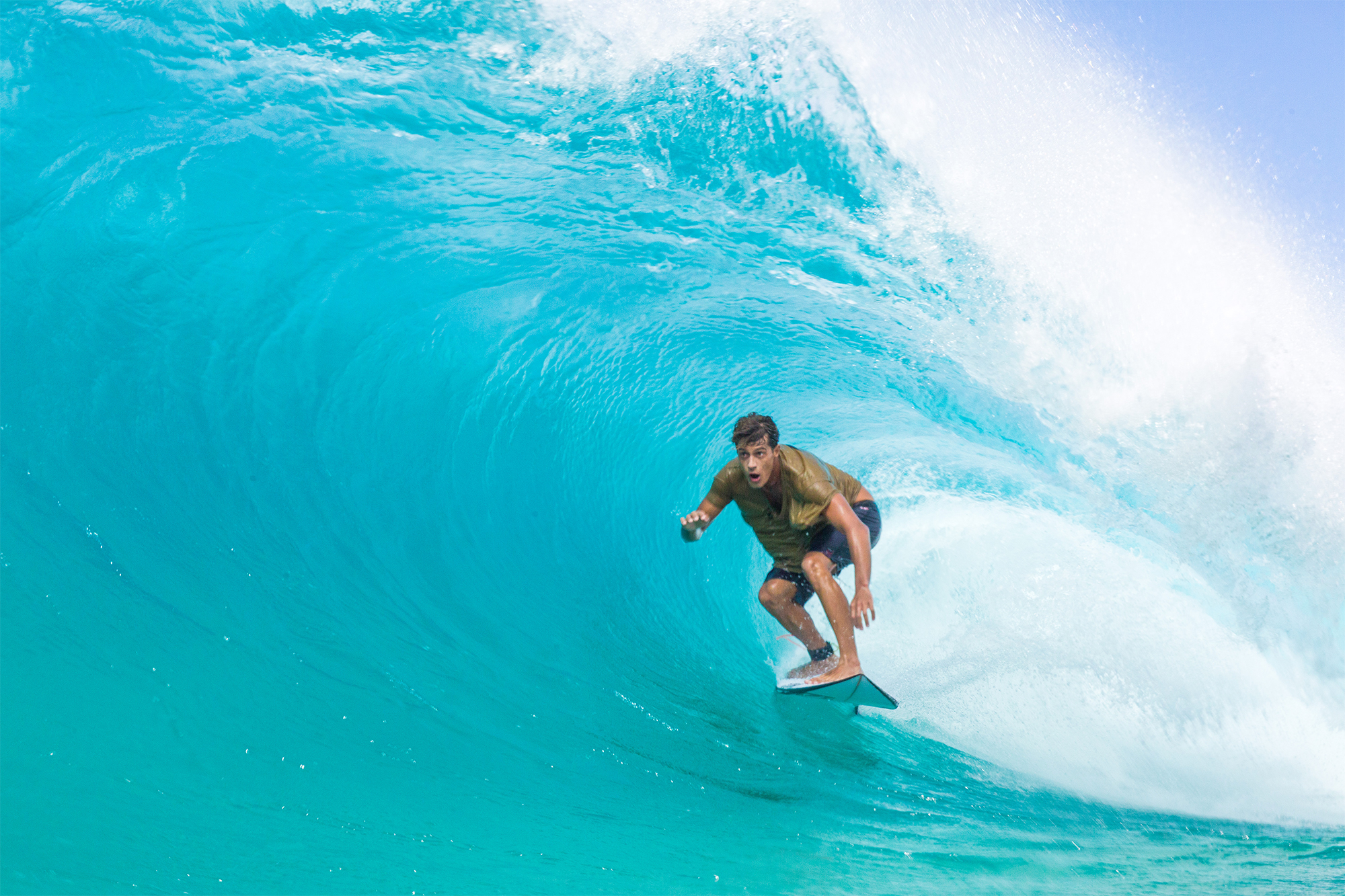
Taj Burrow has never hesitated to hop on a cross-country flight when a Cyclone like Oma starts spinning up off the coast of Queensland. Photo: Juan Medina
That’s a lot of wind over a lot of water, something all surfers like to see. “All of this set up a highly energetic swell event,” Watson says. “Pulsey at times, but also pumping at times. As it hit on Thursday, we saw a more east-northeast swell direction, but as Oma sunk further south, it set up a blend of more east-northeast-east to southeast swell for Friday, which really favored the more protected points/bays along the Goldie. Winds were also southerly which also favors best conditions at many of the key Gold Coast spots.”
And that’s not all. “Even though Oma has weakened and will likely dissipate over the next 24-36 hours, the expansive wind field will keep some swell pumping in through the weekend,” says Watson. “What’s left of Oma will finally track off to the north-northwest and we’ll transition to more east trade swell type of surf for next week. Good news? The tradewinds will be blowing straight at the coast for several days, so there’ll be no shortage of surf for the Gold Coast for quite some time.”
Owen Wright. Photo: Juan Medina
D-Bah, around the corner from the Superbank, offers a peakier option for those who grow tired of leg-burners. Photo: Juan Medina
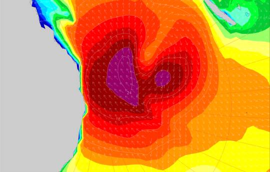
Swell Signature:
Storm Location/Movement: Located near Vanuatu before tracking south-southwest. (At press time, 367NM east of Brisbane.)
Peak Wind: 75 knots.
Peak Seas: Satellite confirmed 25-foot seas.
Travel time: 12-24 hours
Swell Height, Period, Direction: Palm Beach buoy off Queensland coast: 10 feet at 10-13 seconds. East-northeast becoming mix of east-northeast/east and southeast swells. Maximum wave height around 23 feet.
There’s a reason it’s called Surfer’s Paradise. Photo: Andrew Shield
View: Live Superbank Multi-Cam
Nick Vasicek finds a rare left in a land of rights. Photo: Andrew Shield
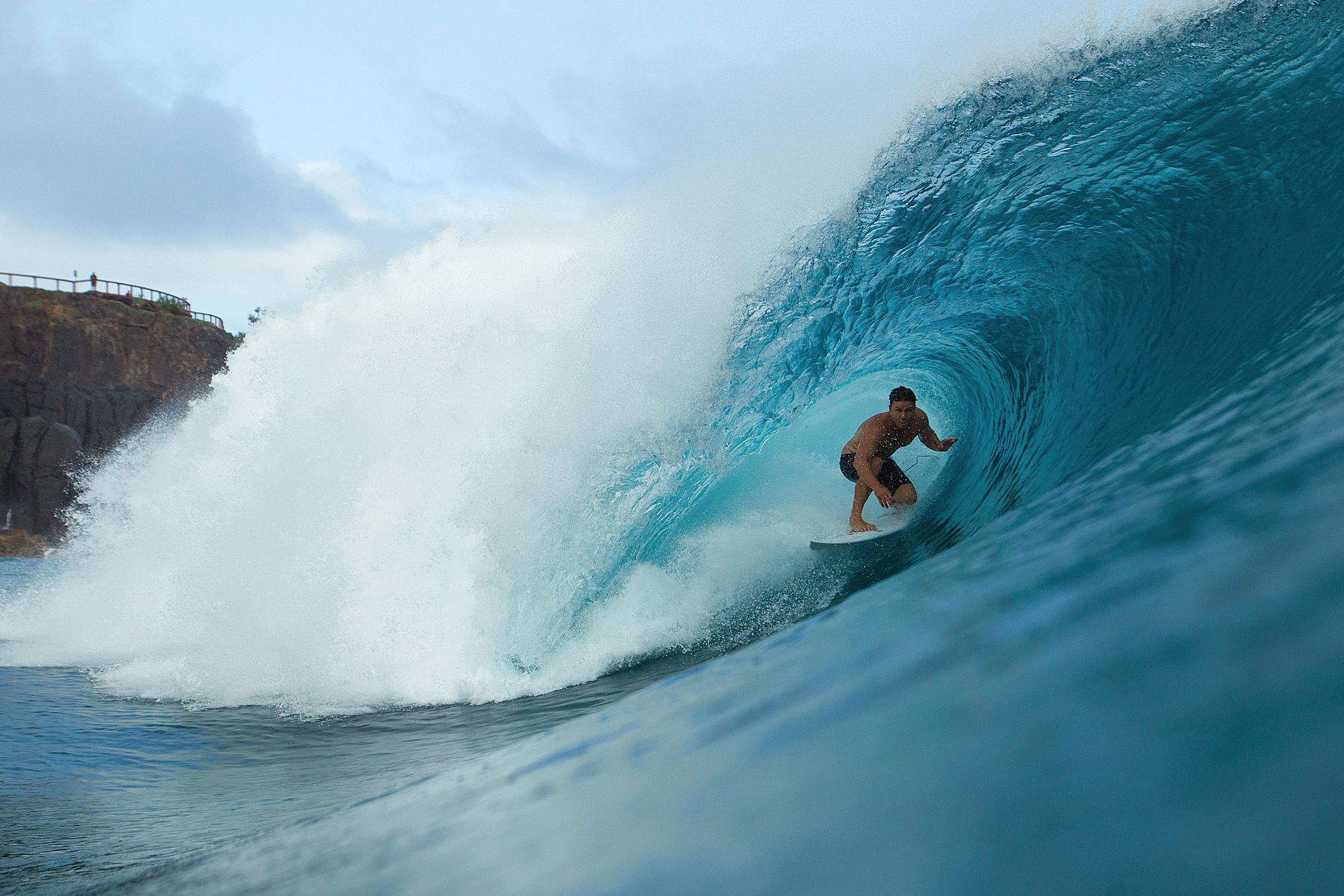
The key thing about making tubes at Kirra is to be able to go as fast as humanly possible — and to not be afraid to backdoor sections. Hey, they may open up. And even if they don’t, there’s always a few seconds of great view inside there. Photo: Ted Grambeau
Mick Fanning, ladies and gentlemen. Here’s what retirement looks like. Photo: Juan Medina
And here’s what friends are for:
2019 WCT rookie Soli Bailey prepping for the first event. Photo: Josh Bystrom
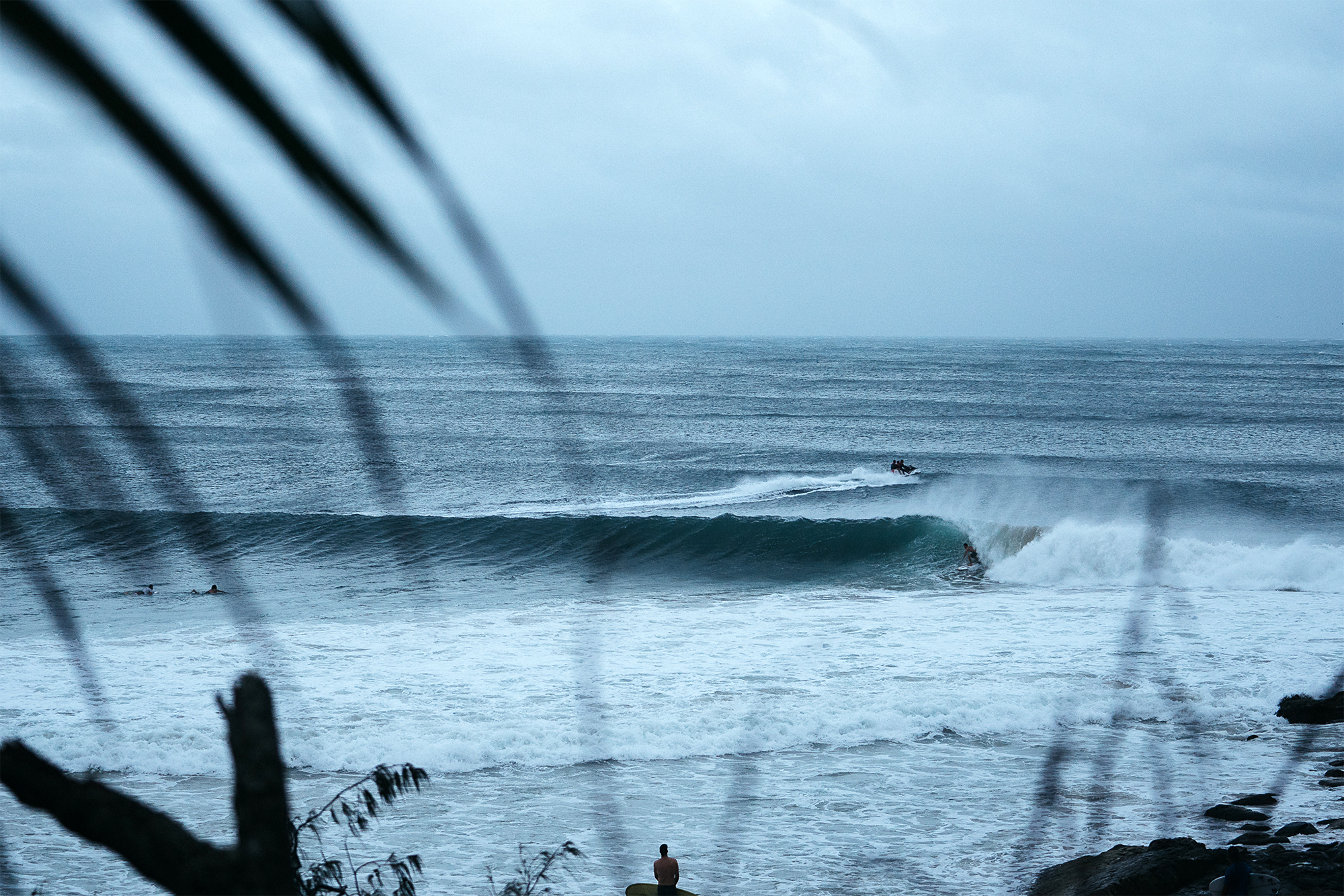
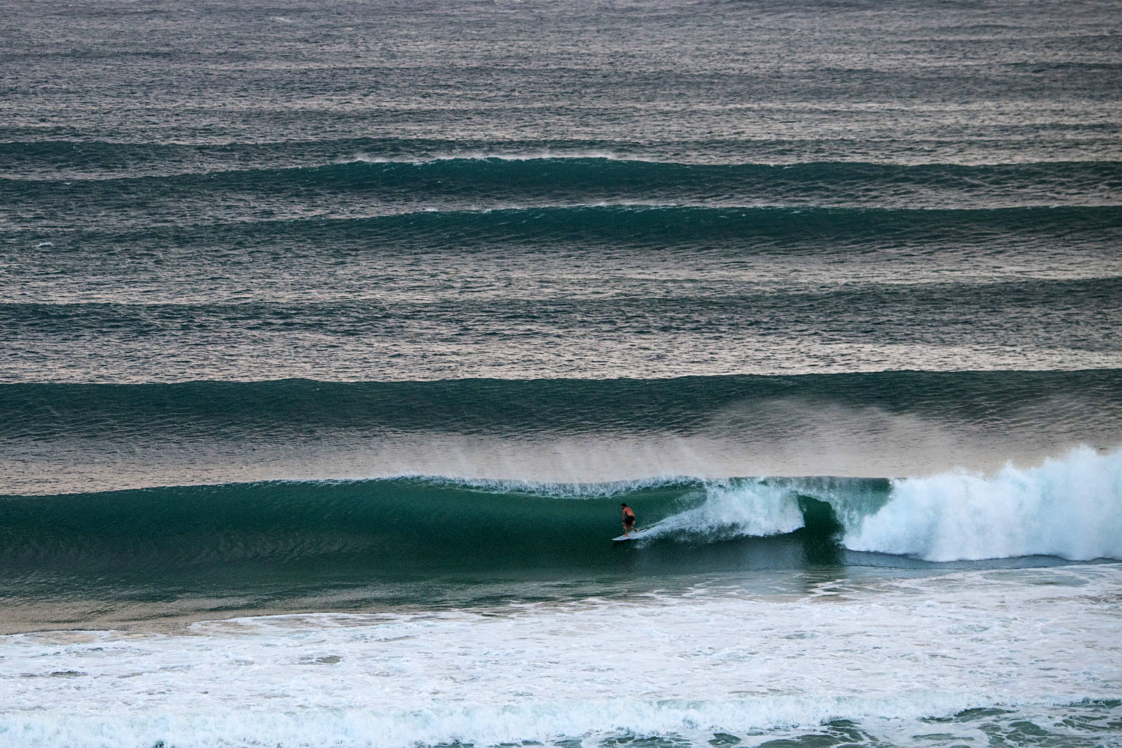
Meanwhile, well north of the Gold Coast, the infamous sand points of Noosa Heads also came alive. Photo: Tom Pearsall
Bagikan Berita Ini


0 Response to "Gallery: Cyclone Oma Sends Gold Coast Into Tube Frenzy - Surfline.com Surf News"
Post a Comment